REVIEW · JASPER
Icefields Parkway Self-Guided Driving Audio Tour
Book on Viator →Operated by Adventures with Action · Bookable on Viator
This drive talks back as you go. It’s a location-triggered audio route that turns the Icefields Parkway into an on-the-road guide, and I especially love the hands-free way the narration starts as you reach each viewpoint, plus how the stories make the geology behind the lakes and waterfalls click fast.
One possible drawback: setup can feel a bit fiddly. You’ll need to download the tour while you have strong cellular or Wi‑Fi, enter a password from your email/text, and start the correct version from the correct location.
In This Review
- Key highlights before you hit the road
- How the Icefields Parkway audio works (and why it feels easy)
- Price and value: $16.99 per group can be a bargain here
- Picking the right version: Jasper-first or Lake Louise-first
- Stop-by-stop: Jasper side viewpoints and short hikes
- Columbia Icefield: the Skywalk and glacier hikes
- Banff side: river cuts, glacier color, and Lake Louise payoff
- How to pace this drive so it fits your day
- Is this the right self-guided audio tour for you?
- FAQ
- How long is the Icefields Parkway self-guided audio tour?
- Is this tour per person or per group?
- Does it work offline without cellular or Wi‑Fi?
- Do I need tickets for the Icefields Parkway attractions mentioned in the audio?
- What language is the tour available in?
- Where does the tour start and end?
Key highlights before you hit the road
- Offline audio and maps: no signal needed after you download
- Audio plays by your location: you stop, park, and the next story cues up
- 140 miles, 76+ stories: a full “taste” of Jasper to Banff in about 3–4 hours
- Flexible pacing: pause anytime, skip stops, and choose short hikes vs just viewpoints
- Good value per car: $16.99 per group (up to 4), not per person
How the Icefields Parkway audio works (and why it feels easy)
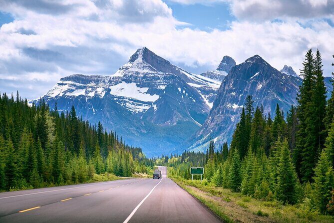
The whole point is simplicity: you drive your own schedule, and the audio tracks your progress. You start the tour at the first story point for your chosen direction, then the stories play automatically as you move along the route. That matters on the Icefields Parkway, where you’ll be bouncing between pullouts, trailheads, and quick photo stops.
I also like that you can start and pause whenever you want. If you want to linger at Athabasca Falls or do the longer version of a hike, you can. If you only want the viewpoint views, you can skip the walking and keep rolling. The app is designed for exactly that stop-and-go style driving.
You can also read our reviews of more guided tours in Jasper

Price and value: $16.99 per group can be a bargain here
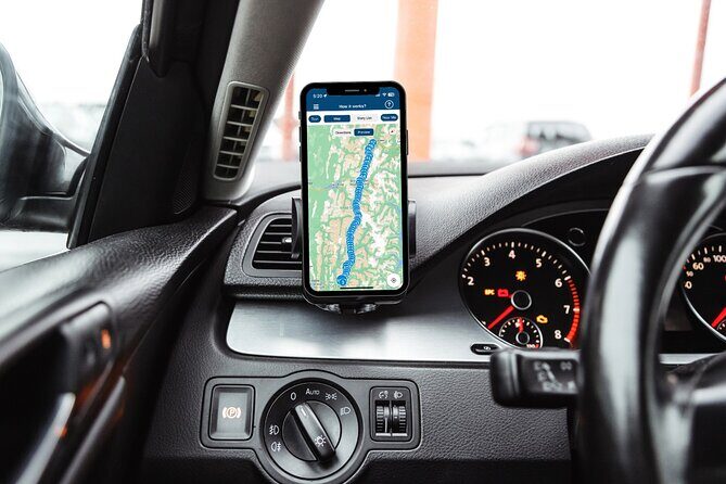
At $16.99 per group up to 4, this is priced like a shared ride, not like a per-person tour. That’s usually how you win on scenic highways: you’re already paying for fuel, parking, and snacks, so having one audio guide for everyone in the car adds real value.
The tour also gives you a lot of “use time.” It’s listed as about 3–4 hours, covering roughly 140 miles and 76+ audio stories. For that, you’re not just buying directions—you’re getting narration that explains what you’re looking at: glacier-fed colors, carved canyons, and why each lake looks the way it does.
Picking the right version: Jasper-first or Lake Louise-first

There’s a small but important detail: the tour has versions. The Jasper version begins in Jasper; there’s also a Lake Louise version. The instructions even say that if you want to start from Lake Louise, you should switch to the Lake Louise version from the app.
This matters because the app’s whole job is location-based audio. If you start the wrong version (or start at the wrong spot), the first few stories can feel like they’re about the wrong places. Before you roll, make sure you’ve launched the version that matches your planned starting point and direction.
Stop-by-stop: Jasper side viewpoints and short hikes
This is where the drive starts feeling like a guided walk-through of the parkway’s biggest “why” questions. Many of the stops are pullouts with quick 5–10 minute windows, and some include short hikes.
Welcome to the Icefields Parkway
You get the big-picture setup: the road connects Jasper and Banff, it’s over 140 miles, and there are 76+ audio stories along the way. The tour also warns you to choose the correct starting point/version.
Jasper SkyTram story
You’ll hear a lead-in about the Jasper SkyTram and the kind of views you can expect. The tour text doesn’t tell you to book it here, but it’s a handy way to make the tram feel like part of the same day’s plan.
Valley of the Five Lakes Trailhead
A 3-mile moderate hike (about 1.5 hours) through five lakes. The narration leans hard on why the water is that sharp turquoise/blue—glaciers helped create the look.
Athabasca Pass Lookout
A quick stop with a strong view into the South Jasper Mountain Range. Mount Edith Cavell (11,033 feet) is named for you as a main feature to watch for.
Horseshoe Lake
This one’s dramatic: it’s U-shaped, with thrill-seekers drawn to a steep drop toward the water. It’s mostly a viewpoint moment, but the story makes the geography feel immediate.
Athabasca Falls
A 75-foot waterfall dropping into a canyon. You also get a time-and-place explanation tied to the Ice Age and how the Athabasca River shaped this pass.
Mount Kerkeslin
A towering Maligne Range peak (9,790 feet). The audio frames it as a historical challenge for early explorers, not just a pretty shape.
Goats & Glacier Lookout
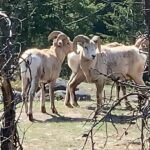
This is one of my favorite kinds of stop: a place where the story explains what you might see. The tour says the cliff has minerals (including salt), and mountain goats come up to lick the rocks.
Mount Christie
Another named peak with a human story attached. The narration points to James Hector (and William Joseph Christie) as the names behind the mountain.
Honeymoon Lake
A calm lake with reflections of Maligne Range mountains. The audio even suggests you might see people in canoes, which helps you picture a quieter contrast to the waterfalls.
Sunwapta Falls
A classic: an easy 2-mile trail (just over an hour) with a wilderness waterfall view. It’s fed by the Athabasca Glacier, and the narration calls out the 60-foot drop and the Stoney-Nakoda meaning of turbulent water.
Endless Chain Ridge
This stop is pure geology education. The narration connects the ridge to the Jurassic period (about 200 million years ago) and later uplift linked to volcanic pressure.
Poboktan Creek trail parking
You’ll see parking for a trail that’s not a quick side quest: 24 miles with an average completion time of four days. The payoff is knowing you’re near big country, even if you don’t hike it.
Alberta 93 (the pile of rocks)
You’re told to pay attention to a pile that doesn’t look like much at first. The narration uses it to explain a story about how the landscape formed over time.
Beauty Creek → Stanley Falls connection
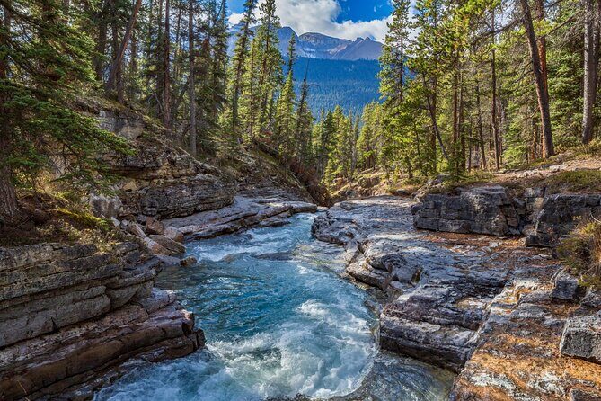
You’ll drive alongside Beauty Creek, described as a clear glacial lake fed by meltwater. The narration links it to Stanley Falls (40-foot plunge) and notes that in colder months waterfalls can turn into sheets of ice.
Stutfield Glacier Viewpoint
A must for glacier watchers: the tour says you can see a huge glacier right from the parkway, stretching 3,000 feet over the cliff face, with mention of double icefalls and why crevasses are a serious hazard.
Tangle Creek Falls
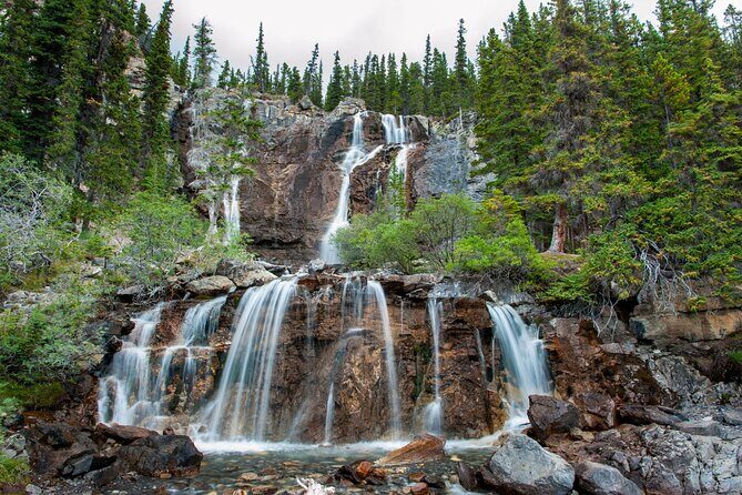
A big cascade (90 feet) alongside the road. The story even adds names: Mary Schäffer Warren (who named Tangle Creek and Endless Chain Ridge) and Samson Beaver as a guide on her journeys.
At this point, you’re getting a pattern: short pullouts that explain what you see, plus a few places where the walking is worth it.
Columbia Icefield: the Skywalk and glacier hikes
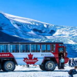
This section is the headline zone for most people. If you only want one part to feel special, make it the ice-and-height area. The tour includes both the narration for the Columbia Icefield Skywalk and nearby glacier hiking options.
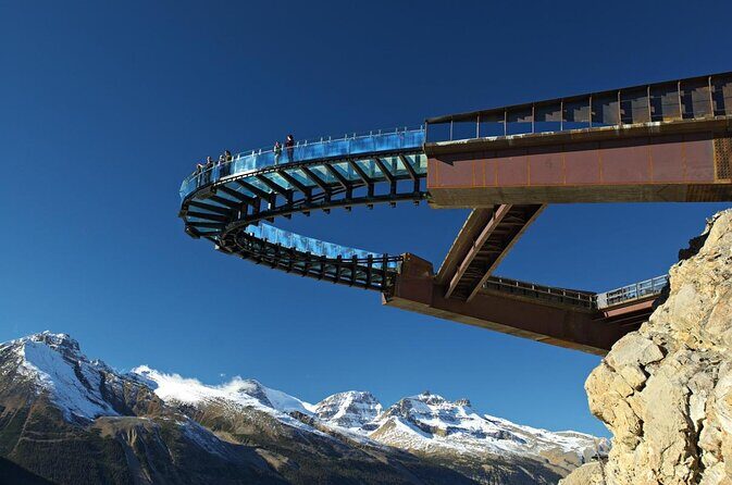
Columbia Icefield Skywalk (walk on glass)
The audio describes the experience as a cliffside glass-floor trail, jutting out about 100 feet over the Sunwapta Valley. You’ll look down past your shoes—more than 900 feet below.
Important: attraction passes aren’t included, so if you want to do this, you’ll need tickets/reservations on your own.
Mount Kitchener
Named for Horatio Kitchener, the audio gives you the World War I connection and the 1916 ship-sinking detail. It’s a nice reminder that names along this route come from real people.
Toe of the Athabasca Glacier Trailhead
A moderate walk (just over one mile) meant for up-close glacier views. This is the kind of stop that helps you turn the narration into a physical experience.
Wilcox Pass Trailhead
A tough hike on paper (7 miles), but the narration explains most visitors turn around after about a mile to reach a viewpoint. The viewpoint looks over Mount Snow Dome at the crossroads of Jasper and Banff.
Parker Ridge Trail
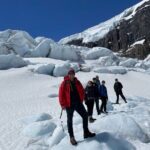
A 4-mile hike with a set expectation of a little over two hours for alpine meadows and panoramic views. The narration connects it back to the turquoise lakes and the Columbia Icefield for context.
Panther Falls (plus Bridal Veil option)
An easy 1.5-mile hike (about 30 minutes) to a 210-foot cascade. The audio also offers a two-for-one idea: you can extend to Bridal Veil, described as five times the size of Panther Falls.
Weeping Wall viewpoint
A viewpoint story about water that doesn’t always flow like a normal waterfall. The tour explains the cliff can “weep” depending on natural springs and seasonal conditions—so timing and weather can change what you see.
Mount Coleman
You get another peak identity lesson (10,285 feet). The audio also frames it in exploration history terms, which helps you understand why these mountains matter to people, not just cameras.
HI Rampart Creek Wilderness Hostel (pass-by story)
You’ll hear a short note about this humble lodging and a tourism change that started almost 100 years ago. It’s a quick reminder that this corridor isn’t only nature—it’s also a travel story.
A few more Jasper tours and experiences worth a look
Banff side: river cuts, glacier color, and Lake Louise payoff
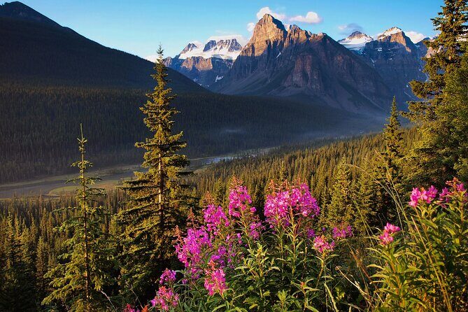
Once you move toward Banff territory, the audio keeps tightening the connection between what you see and how it formed. Here you’ll get a mix of quick stops and short hike opportunities with names you’ll recognize later in the day.
Saskatchewan River Crossing (1882 story)
A history stop: before the parkway, crossings looked different. The narration describes a plank drifting across the river with a horse and carriage waiting, linked to John Walter and the year 1882.
Howse River → Howse Pass Viewpoint
Turn into the parking area for views of the river and mountains beyond. It’s straightforward and works well if you want a breath-and-photo stop without a long hike.
Mistaya Canyon Trailhead (Banff)
A moderate 1.5-mile walk (about 40 minutes) to the bottom of a deep gorge with water. If you’ve been skipping hiking, this is a solid “try one trail” moment.
Mount Chephren
The audio mixes climbing difficulty with naming. It calls out steep angular slopes for pro-climbers and explains that the park settled on the name after an ancient Egyptian Pharaoh connected to the second-largest pyramid in Giza.
Waterfowl Lake Viewpoint
You’ll see the lake right next to the parkway. The narration adds a cultural time layer—its role in the 1960s counterculture scene is mentioned via the hippies connection.
Mt Patterson → Snowbird Glacier Viewpoint
A glacier story tied to how it flows. The tour says the Snowbird Glacier gets its name from the way it extends down Mount Patterson, like wings.
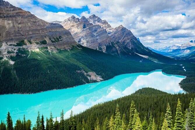
Peyto Lake
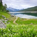
A glacier-fed lake with a bright turquoise color promise. The narration gives you two options: a side road overlook above the lake, plus a 2-mile trail around the lake’s circumference if you want extra time on foot.
Bow Lake
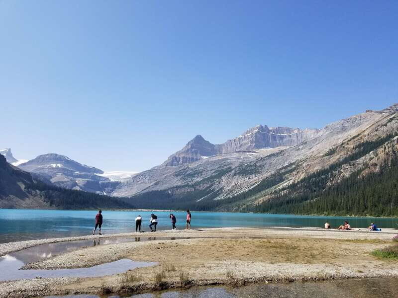
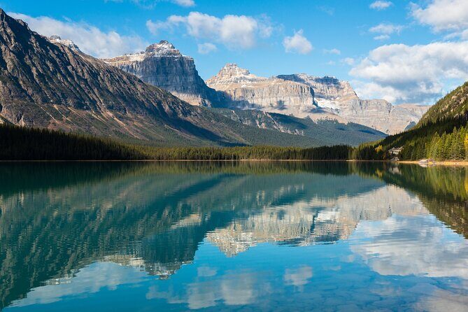
A reflective blue water scene with Mount Jimmy Simpson to the right. The audio also includes the naming origin for Jimmy Simpson as an English immigrant, which is a fun way to keep the geography human.
Crowfoot Glacier Viewpoint
A glacier receding story with shape-based naming. The audio describes three lobes and says you’ll see a crow’s foot look because of how the ice formed.
Wapta Icefield
The narration focuses on the name meaning (Stoney-Nakoda for running water) and mentions marine discoveries tied to the icefield. This is where the science angle starts feeling less like trivia and more like a reason glaciers get studied.
Hector Lake Viewpoint
A glacial lake under Lilliput Mountain and Mount Balfour. It’s described as very popular with photographers, which usually means good light opportunities depending on time of day and cloud cover.
Lake Louise (end)
The tour ends here, with a note that you should keep driving straight for another 5–10 minutes to reach the Lake Louise area.
How to pace this drive so it fits your day
The tour is built for 3–4 hours, but the Icefields Parkway can eat time fast. Your best strategy is to decide what kind of visitor you are before you start.
- If you want maximum “wow” with minimal hiking, focus on the viewpoints: Athabasca Pass, Stutfield Glacier Viewpoint, Weeping Wall, and the glacier/lake stops like Peyto and Bow Lake.
- If you like walking but want to stay on schedule, pick one trail segment (like Valley of the Five Lakes, Sunwapta Falls, or Mistaya Canyon) and treat the rest as quick look-and-go.
Also plan around weather and daylight. On glacier terrain, conditions can change quickly. And the tour itself keeps many stops at a “5 minutes” feel, which works best if you’re not scrambling for parking or rushing your photos.
Is this the right self-guided audio tour for you?
I’d book this if you want a flexible, independent way to understand what you’re seeing on one of Canada’s best-known drives. It’s also a strong fit if you’re not trying to “collect” every hike, but you do want narration that connects glaciers, rivers, and mountain names into a coherent story.
I’d think twice if you dislike apps and passwords, or if you tend to arrive with low planning time. The tour’s value depends on having it downloaded and ready before signal drops—then starting at the correct version and first story point.
FAQ
How long is the Icefields Parkway self-guided audio tour?
It’s listed as about 3 to 4 hours to complete, and the route is described as over 140 miles long.
Is this tour per person or per group?
It’s priced at $16.99 per group (up to 4 people).
Does it work offline without cellular or Wi‑Fi?
Yes. After you download the tour while you have strong cellular or Wi‑Fi, it includes offline maps and the audio works without signal.
Do I need tickets for the Icefields Parkway attractions mentioned in the audio?
Attraction passes, entry tickets, or reservations are not included. The tour includes stories about places like the Columbia Icefield Skywalk, but you would handle any ticketed access separately.
What language is the tour available in?
The tour is offered in English.
Where does the tour start and end?
The meeting point is listed as Lake Louise, AB T0L 1E0, Canada, and the tour ends at Lake Louise. The instructions also note that there are different versions, and you should switch to the Lake Louise version if you’re not starting in Jasper.
Should you book this?
If you’re driving the Icefields Parkway and want a guide that doesn’t slow you down, book it. The best reason is the mix of offline convenience and story-driven context for the lakes, passes, and glaciers—so your stops feel smarter, not just scenic. Just do one thing first: download it with strong signal and start the correct version for your starting point.