REVIEW · CAPE BRETON ISLAND
Cabot Trail: a Smartphone Audio Driving Tour
Book on Viator →Operated by Tripvia Tours · Bookable on Viator
This app turns road time into stories. The Cabot Trail: a Smartphone Audio Driving Tour gives you a stop-by-stop guide built for a long, scenic drive on Cape Breton Island, with narration and prompts timed to where you are. I like that it feels like a smart co-pilot without forcing you to stare at a screen.
My favorite part is the value: you buy once per vehicle (up to 15 people per booking), so the price is easy to justify even for a group. I also really like the offline setup: once you download, you’re not paying for data mid-drive and you’re not stuck hoping for cell signal to save the day.
The main drawback to consider is the download/start process. If your download isn’t complete or your phone can’t play the audio smoothly, you may need to manually trigger stops.
In This Review
- Key points at a glance
- Price and value: $9 per group, but one per vehicle
- Offline audio on a cell-sparse drive: download first, then relax
- Timing: 4 to 5 hours, but truly no time pressure
- How the tour guides you: GPS cues, sound prompts, and less screen time
- Stop-by-stop: Bras d’Or Lake to Cape Smokey viewpoints
- Bras d’Or Lake glimpses
- Alexander Graham Bell and his museum area
- Plaister Mines: what they were mining
- Goose Cove Brook and the waterfall payoff
- North River Wilderness Area: trails and big acreage
- Plaster Provincial Park and the coastal edge
- Cape Smokey: pull off panorama, then picnic park comfort
- Where the drive turns into short walks: Ingonish, trails, and family-friendly nature stops
- Ingonish as five villages
- Mi’kmaq stories around the two harbours
- Trails, whales, golf, and goats
- Whale country: Pleasant Bay
- Lone Shieling and the short sugar maple walk
- MacIntosh Brook trail for families (and dogs)
- Skyline trail headland views: easy walk, big payoff
- The geology lesson you can actually feel: faults, plates, and three continents
- Bras d’Or terrane
- Polletts Cove – Aspy Fault Wilderness Area
- Appalachian Mountains link
- Aspy Bay red sand bar
- Acadian and Mi’kmaq culture stops: Cheticamp, Mi-careme, and small-town details
- Cheticamp River and the park entrance feel
- Acadian capitals and the lived-in Coast
- Mi-careme mask tradition
- Refuge history on the trail: Acadians after 1755
- Churches side by side
- Practical driving tips: how to make the most of pull-offs and short stops
- Who should book this Cabot Trail smartphone audio tour
- Should you book it?
- FAQ
- FAQ
- Do I need data or signal during the tour?
- How much does the tour cost?
- Do I need a separate ticket for each person?
- How long does the tour take?
- Where does the tour start and end?
- What language is the audio offered in?
- What do I need to use the tour?
- Is it available every day?
- Can I revisit the tour after I buy it?
Key points at a glance

- One purchase per vehicle makes it cheaper for families and friend groups
- Download once, then go offline for the narration and stop guidance
- No rushing: take as long as you want through the full drive
- GPS-triggered cues help you know when to pull over
- Lots of stops worth leaving the car for short walks, viewpoints, and picnic pauses
- Some tech hiccups possible, especially with spotty signal during download or auto-play
Price and value: $9 per group, but one per vehicle
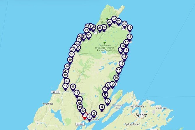
This is one of those deals that only works because of how it’s priced. The tour costs $9.00 per group (up to 15 people), and the idea is that you need only one tour per vehicle. If you’re traveling as a couple, that’s a low-risk experiment. If you’re a family in one rental car, it turns into a small line item compared with tours where you pay per person.
You also get something that matters on the Cabot Trail: flexibility. This isn’t a guided bus tour with a schedule that whips you along. Instead, you can pause for photos, linger at viewpoints, or take longer on short trails. That “stretch the day” style is where the cost makes sense.
You can also read our reviews of more tours and experiences in Cape Breton Island.


Offline audio on a cell-sparse drive: download first, then relax
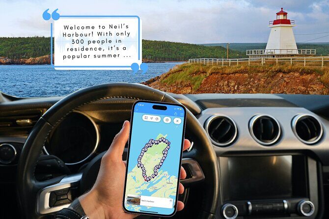
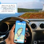
Cape Breton’s roads are gorgeous, which is exactly why your phone might struggle with signal. The tour is designed to work around that with a simple rule: you need good service only for the initial download. After that, no signal or data is required during the tour.
In practice, this means:
- Download the full tour while you’re on reliable Wi-Fi (or at least strong mobile service).
- Do the starting steps before you hit the most remote stretches.
- If auto-play doesn’t kick in perfectly at a stop, you can still follow along using the tour’s map and prompts.
A real-world note from user experience: when download steps didn’t go smoothly, narration and photo portions could fail in spotty coverage areas. The tour’s own guidance makes this clear—getting everything downloaded before you drive is the difference between smooth sailing and frustration.
Timing: 4 to 5 hours, but truly no time pressure
The tour is listed as about 4 to 5 hours, which is helpful when you’re planning food stops and bathroom breaks. But the bigger win is that the tour is yours to keep and you can take as long as you like. There are no hard turn-off times or countdowns forcing you back into the car.
That matters because Cabot Trail driving is rarely a straight line. You’ll find yourself pulling over for:
- short viewpoint pauses,
- waterfall access walks,
- and places where a 20-minute stop becomes 50 minutes because the view refuses to be ignored.
Also, this is a private activity in the sense that it’s just your group in your vehicle—no awkward “wait for the slowest person” dynamic.
How the tour guides you: GPS cues, sound prompts, and less screen time

One thing I appreciate with self-guided driving tools is what you don’t have to do. This tour is built to reduce the constant phone-tapping while you drive. You should still stop safely before interacting, but the narration and cues are meant to guide you hands-free.
What you can expect from the experience:
- narration triggered as you approach stops,
- prompts that tell you what to look for and where to pull in,
- and occasional interactive bits (including quizzes at the end of many stops).
If you’re going in the wrong direction or your timing slips, auto-triggering can feel off. In those cases, plan on manually starting the audio at the right moment and using the on-screen map to catch up.
Stop-by-stop: Bras d’Or Lake to Cape Smokey viewpoints
The tour begins with water, then moves into the human stories behind the coastline and interior.
Here’s what the early stretch does well:




Bras d’Or Lake glimpses
You’ll get early peeks of Bras d’Or Lake, a 90 km long body of water shaped into long fingers reaching into northern Cape Breton. It’s a great opener because it quickly shows you the scale of the region—salt and freshwater vibes in the same area.
Alexander Graham Bell and his museum area
Next, you hear Alexander Graham Bell explain why there’s a museum dedicated to him. The audio brings context you’d otherwise miss if you only drove past the signs. This is a solid stop whether you want a quick look or you plan to visit the National Historic Site and Museum nearby.
Plaister Mines: what they were mining
Then you swing into industrial history with Plaister Mines. The audio focuses on what was mined and the reason that mining mattered there. If you usually skip roadside history boards, this is one stop type that can flip the script and make the scenery feel more specific.
Goose Cove Brook and the waterfall payoff
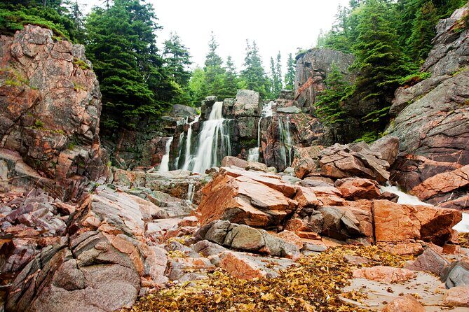
As you continue, you reach one of the prettiest spots along this section where multiple brooks join before flowing into a cove. If you love waterfalls, the audio points you toward beautiful options along Goose Cove Brook with access that’s described as easy. The trick here is timing: bring a little patience so you can get out and actually walk, not just photograph from the road.
North River Wilderness Area: trails and big acreage
You’ll also learn about the North River Wilderness Area, protecting over 5,000 hectares (about 12,000 acres). That kind of number isn’t trivia—it helps you understand why the area feels rugged and why trails can range from easy to more serious. Even if you only do a short walk, it’s satisfying to step into protected terrain.
Plaster Provincial Park and the coastal edge
The route continues with Plaster Provincial Park, including facts about the park itself and what you’ll see nearby as you drive along its edge. This stop works best if you enjoy “slow drive thinking”—reading the road signs and letting the audio connect what you see to what’s being protected.
Cape Smokey: pull off panorama, then picnic park comfort
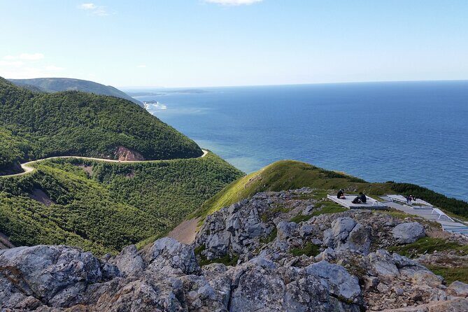
A famous roadside moment comes next: the audio builds to Cape Smokey, including a pull-off on your ascent for a panoramic ocean view. Then you reach the top and the Cape Smokey Picnic Park, with picnic tables, flush toilets, and scenic lookouts.
That’s a practical combo. Views are great. Toilets are even better.
Where the drive turns into short walks: Ingonish, trails, and family-friendly nature stops

As the tour moves toward the Ingonish area and into the wider Cape Breton Highlands National Park region, it keeps returning to two things: viewpoints and easy walking breaks.
Ingonish as five villages
You’ll hear that Ingonish isn’t just one spot—it’s made up of five villages. It sits at the “gates” to the national park, and the audio frames why the area draws visitors: fresh and salt water beaches, plus a lot of ways to spend a few hours without rushing.
Mi’kmaq stories around the two harbours
You’ll also get a long, time-depth story about how the two harbours supported the Mi’kmaq for over 9,000 years, and how that benefit continues today. This is the kind of narration that gives meaning to what would otherwise feel like just another coastal pull-off.
Trails, whales, golf, and goats
The tour literally spells out the vibe with the heading Trails, Whales, Golf & Goats, and promises a rundown of what’s around. Even if you don’t have time to do it all, the audio helps you pick one or two priorities.
Whale country: Pleasant Bay
If whale watching is high on your list, you get the practical flag at Pleasant Bay, described as the whale watching capital of Cape Breton. This stop is worth planning around because whale watching is one of those activities where your best chance is usually tied to where the locals go.
Lone Shieling and the short sugar maple walk
For a quick “get out of the car and feel history” stop, you’ll reach the Lone Shieling, a replica of an old Scottish crofter’s hut. It comes with interpretive panels and a 15-minute walk through old sugar maples. It’s not a marathon, and it’s easy to fit between viewpoints.
MacIntosh Brook trail for families (and dogs)
The MacIntosh Brook trail is described as about a 30-minute walk, suitable for the whole family, and even noting it works with a dog. The path follows a babbling brook to a woodland waterfall. This is exactly the kind of guided suggestion that turns a good drive into a memorable one.
Skyline trail headland views: easy walk, big payoff
Toward the tour’s later sections, you’re guided to the Skyline trail headland cliff area. The audio says it’s famous for dramatic views of the Cabot Trail winding along French Mountain, and it’s rated an easy walk with a well-groomed path. If you only do one “walk with views” stop, this is the type of stop that tends to deliver.
The geology lesson you can actually feel: faults, plates, and three continents

Some audio tours tell you facts that fly by. This one connects geology to what you’re seeing and why it’s different from place to place.
Here are the key science-to-road connections built into the drive:
Bras d’Or terrane
You’ll hear the term Bras d’Or terrane and get a sense of the surrounding geology and its history. The idea is to help you understand why this region looks and feels the way it does.
Polletts Cove – Aspy Fault Wilderness Area
The audio points you to the Polletts Cove – Aspy Fault Wilderness area and calls out the collision of the three continental plates. That’s heavy stuff, but it’s framed as a reason the terrain is so rugged.
Appalachian Mountains link
You’ll learn that the plateaus are part of the northern tip of the Appalachian Mountains of eastern North America. Roadside lookoffs help you see the fault line cutting through highland plateaus. If you enjoy learning why a view looks the way it does, this part gives your photos context.
Aspy Bay red sand bar
The tour includes Aspy Bay with a description of a red sand bar protecting the South and North Aspy Bays. It’s the kind of detail that makes you look closer at the water’s edge instead of treating it like background.
Acadian and Mi’kmaq culture stops: Cheticamp, Mi-careme, and small-town details
Cabot Trail driving is scenic, but what really makes it stick is when you understand who shaped the land. The tour blends Indigenous and Acadian stories without making them feel like a lecture.
Cheticamp River and the park entrance feel
You’ll hear about the Cheticamp River as the western entrance of the national park, with nearby trails and a campground. The audio points out an estuary detail where gravel and sand sweep across red bluffs, almost separating the river from the sea.
Acadian capitals and the lived-in Coast
Cheticamp is described as one of the Acadian capitals of the world, with whale watching, a museum, restaurants, and an excellent golf course. The audio also points you toward Plage St. Pierre beach and campground on Cheticamp Island.
Mi-careme mask tradition
If you want culture you can watch and try, the tour references the Acadian tradition of Mi-careme and mentions the Centre de la Mi-careme, including making your own mask if you have time.
Refuge history on the trail: Acadians after 1755
A big theme returns with the story of refugees after the great expulsion of 1755 in Nova Scotia. You’ll hear about a walk through history where 30 Acadian families once lived, plus le chemin du Buttereau and Le Buttereau, French for little hill, where seven Acadian families once lived. Even if you only do a quick roadside stop, the audio makes these places feel inhabited, not just historic.
Churches side by side
One of the later stops includes a description of two churches standing side by side, with white clapboard and grey spires, described like fraternal twins who decided to dress alike. The audio explains how that pairing came to be.
Practical driving tips: how to make the most of pull-offs and short stops
This is a driving tour, so the “how” matters as much as the “what.” Here’s how I’d plan it to get the best day.
- Use the audio as your stop checklist. Many stops are described as accessible and designed for quick visits. If you treat the tour like a list and not just background sound, you’ll get more out of it.
- Plan for toilets and food breaks. The tour explicitly calls out flush toilets at Cape Smokey Picnic Park and suggests a famous roadside restaurant stop for road-trip essentials. One of the iconic stops since 1976 offers food like legendary lobster sandwiches.
- Don’t fight the direction. If you drive in the opposite direction, some auto-cues may be off. It’s still workable, but be ready to manually start what you miss using the map and cues.
- If audio doesn’t auto-advance, don’t panic. The tour works even when you manually trigger stops. That’s a normal part of GPS-triggered systems in real-world conditions.
- Check access for specific attractions. One stop in the broader area can be affected by closures; for example, Mary Anne Falls has had a permanently closed pedestrian route since 2022 per recent reported issues. Before you plan a walk based on a stop, it’s smart to double-check current access.
Who should book this Cabot Trail smartphone audio tour
This one fits best if you want:
- history and natural features without hiring a private guide,
- a self-paced road trip where you can pull over for viewpoints and short walks,
- and a tool that helps you cover more than you’d likely notice on your own.
It’s also a strong choice if:
- you’re traveling as a couple, friends, or family in one vehicle,
- you want your group to share one set of audio guidance,
- and you like learning while you drive instead of only at stops.
If you need a live person correcting you in real time, this isn’t that. It’s a guide in your car, not a guide sitting with you.
Should you book it?
If your goal is to get more out of a Cabot Trail day—more stops, more meaning, more “I didn’t know that” moments—this tour is an easy yes. The price per vehicle, plus the offline-first design, makes it low-risk and high-reward.
I’d book it if you’re willing to do one key thing right: download fully and run the tutorial steps before you leave reliable Wi-Fi. If you rush that part, you can end up dealing with audio glitches that drain the fun.
FAQ
FAQ
Do I need data or signal during the tour?
No. After you download the tour to your phone, it’s designed to run without signal or data. You only need a good mobile or WiFi connection for the initial download.
How much does the tour cost?
It’s $9.00 per group, up to 15 people.
Do I need a separate ticket for each person?
No. The tour is meant to be purchased once per vehicle, so one booking can cover everyone in your car (up to the group limit).
How long does the tour take?
The tour is listed as 4 to 5 hours approximately, and you can take as long as you like with zero time constraints.
Where does the tour start and end?
It starts at Buckwheat Corner, NS B0E 1B0, Canada, and ends back at the meeting point.
What language is the audio offered in?
The tour is offered in English.
What do I need to use the tour?
You’ll need a smartphone or tablet to access and play the tour.
Is it available every day?
Yes. It’s listed as open Monday through Sunday from 12:00 AM to 11:30 PM during the listed operating dates.
Can I revisit the tour after I buy it?
Yes. It’s yours to keep, so you can revisit it as often as you like.